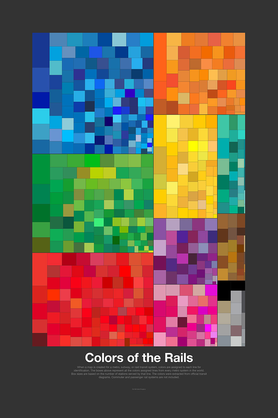
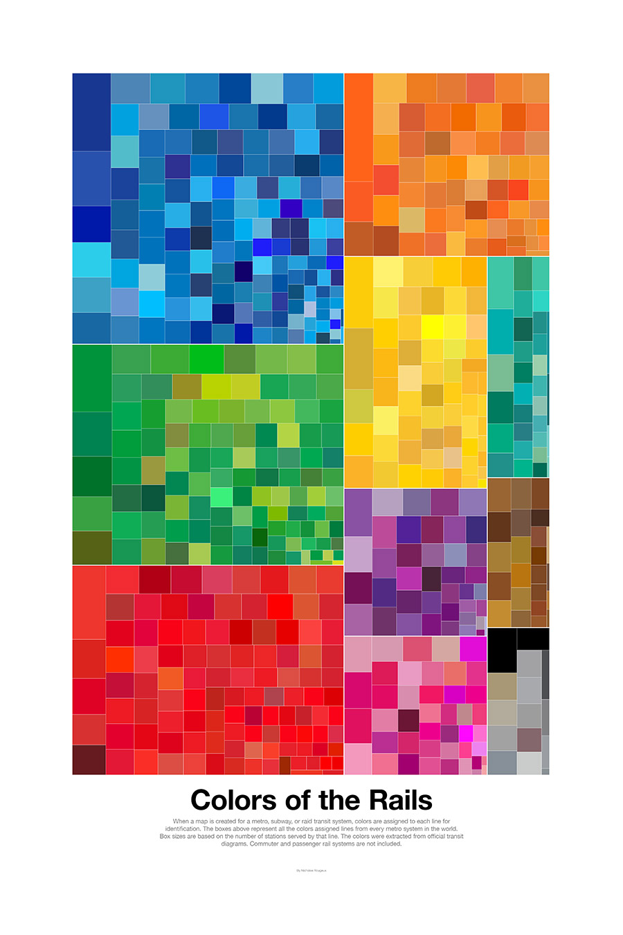
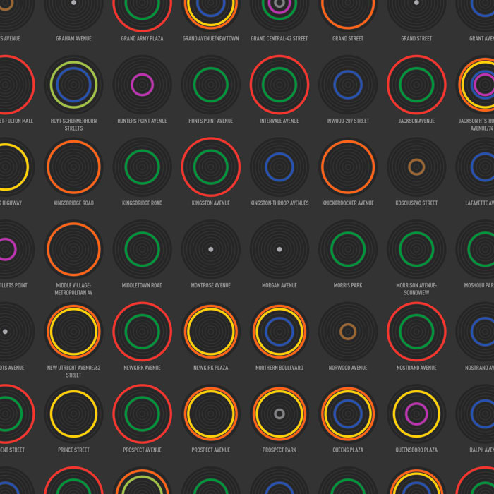
When a map is created for a metro, subway, or raid transit system, colors are assigned to each line for identification. After creating the Global Subway Spectrum a few years ago which catalogs all these colors, I wanted to revisit the idea and create something new with updated data that transit fans like myself would enjoy hanging on their wall.
The result is Colors of the Rails, colors collected of official diagrams of metro lines and combined into a single graphic grouped by color family. Box sizes are based on the number of stations served by that line. Bigger boxes = more stations served.
The interactive diagram below was created as a way to generate graphics for the posters and I had such a fun time using it that I've made it available to enjoy below.
See the posters | About the data
Hover over or click boxes to see line info and other lines in that system.
Posters
Posters are available in light and dark.
About the data
Wikipedia's list of metro systems was the source of systems around the world. The colors and station counts were extracted from official transit diagrams available on the website of the owner, organization, or government managing the system. Commuter and passenger rail systems are not included.
Press
- Best of the visualisation web... October 2016, December 9, 2016, Visualising Data
- Understanding Our Cities, Thanks To Beautiful Maps, February 7, 2017, Forbes
- Data Visualisation - a selection of my favourites Feb 2017, February 15, 2017, Content Loop
Published November 3, 2016
