I love creating things based on subway maps.
Losing myself in something designed to prevent others from getting lost is a wonderful irony. Most of us are familiar with maps focused on wayfinding and less on geographic accuracy. I wanted to explore the parts that make up geographically accurate maps and create something for others like me who love them.
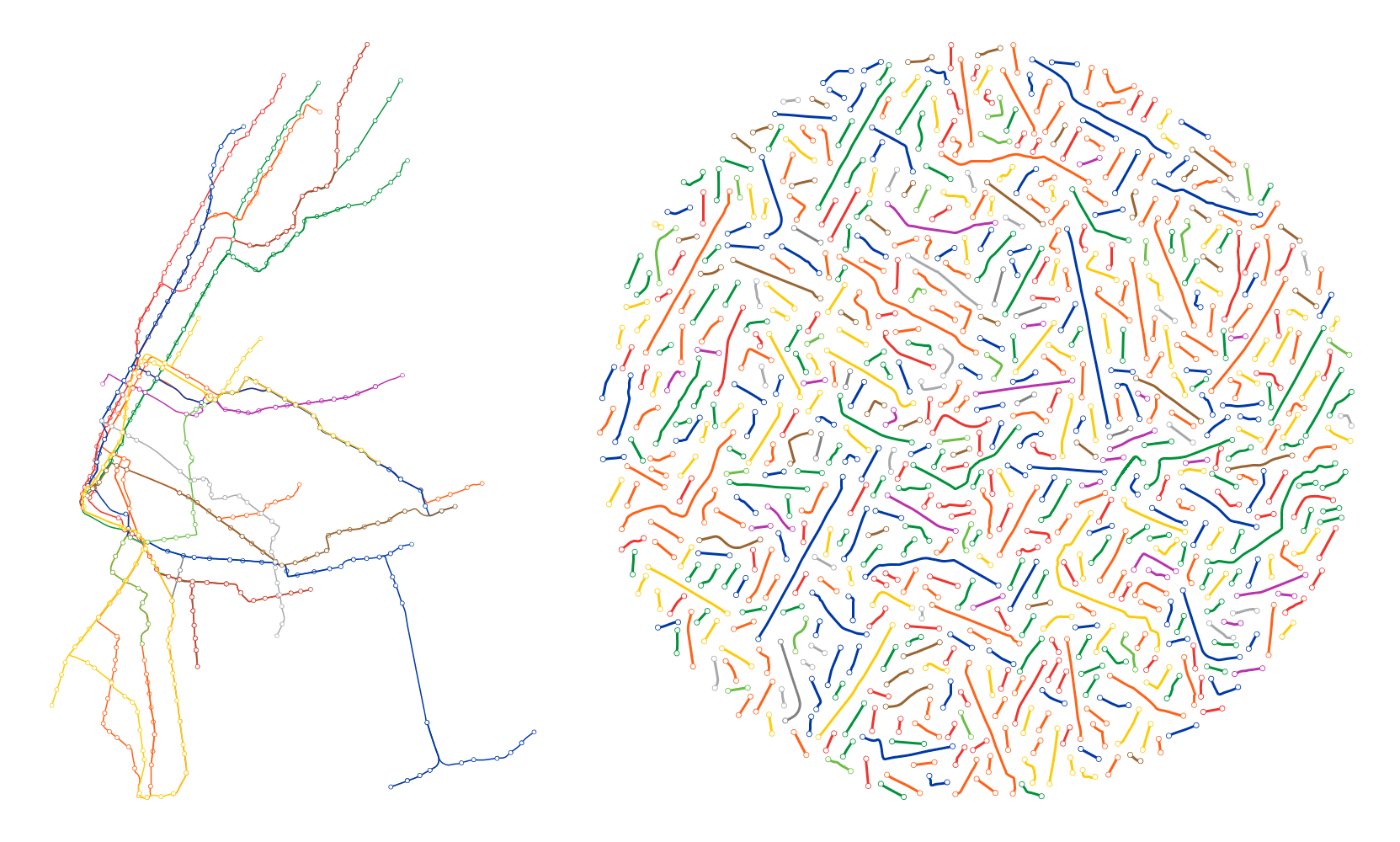
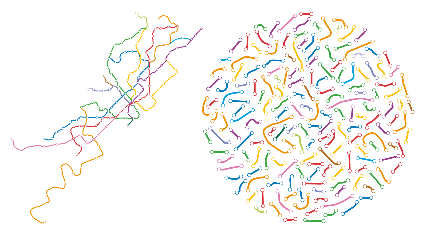
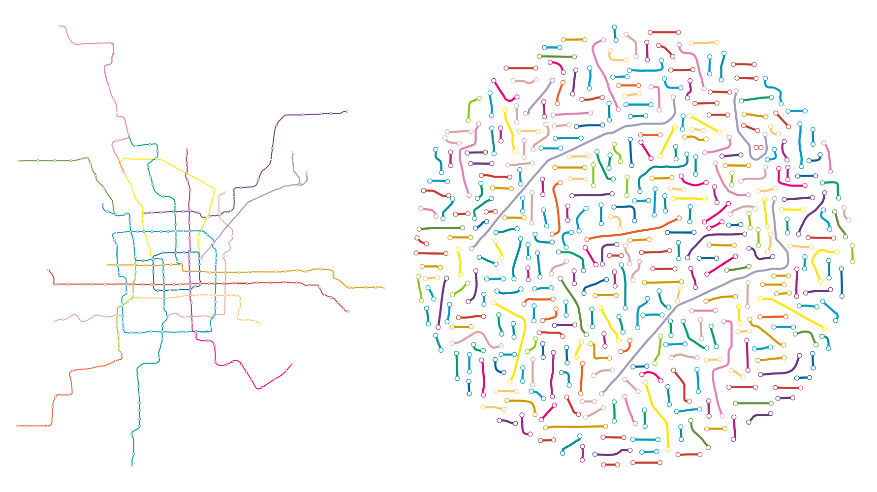
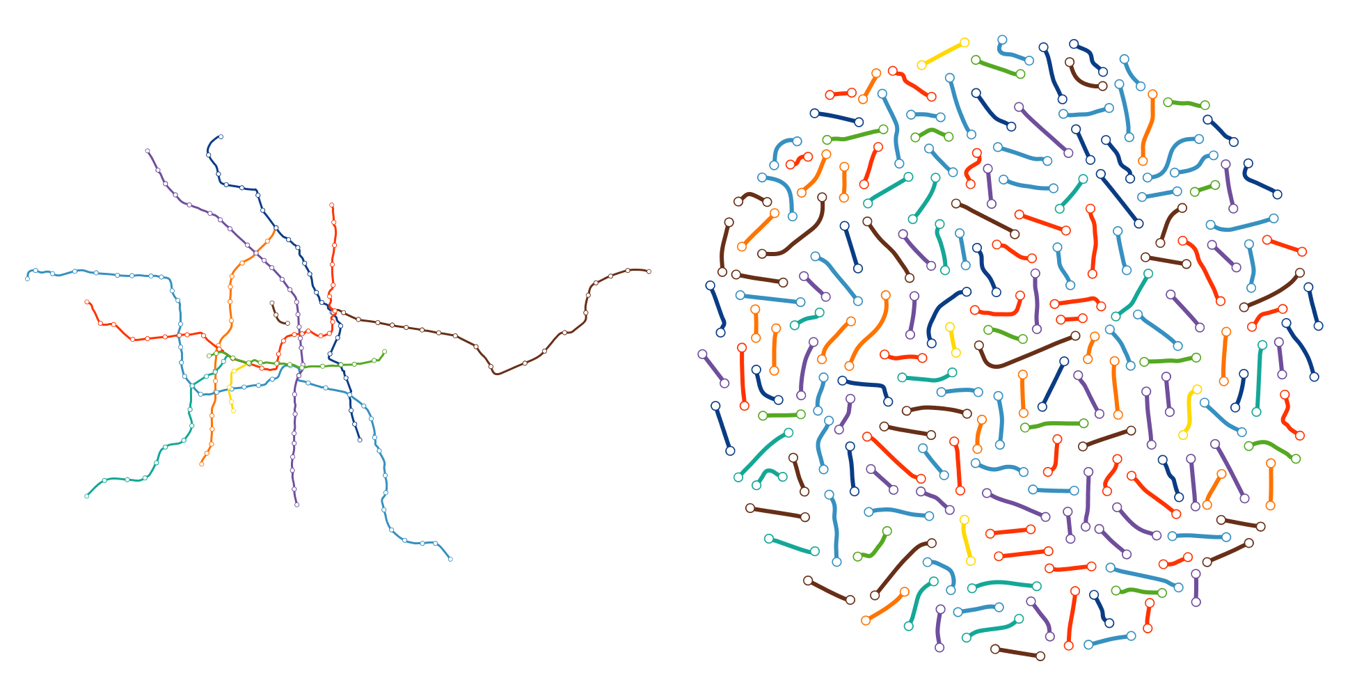
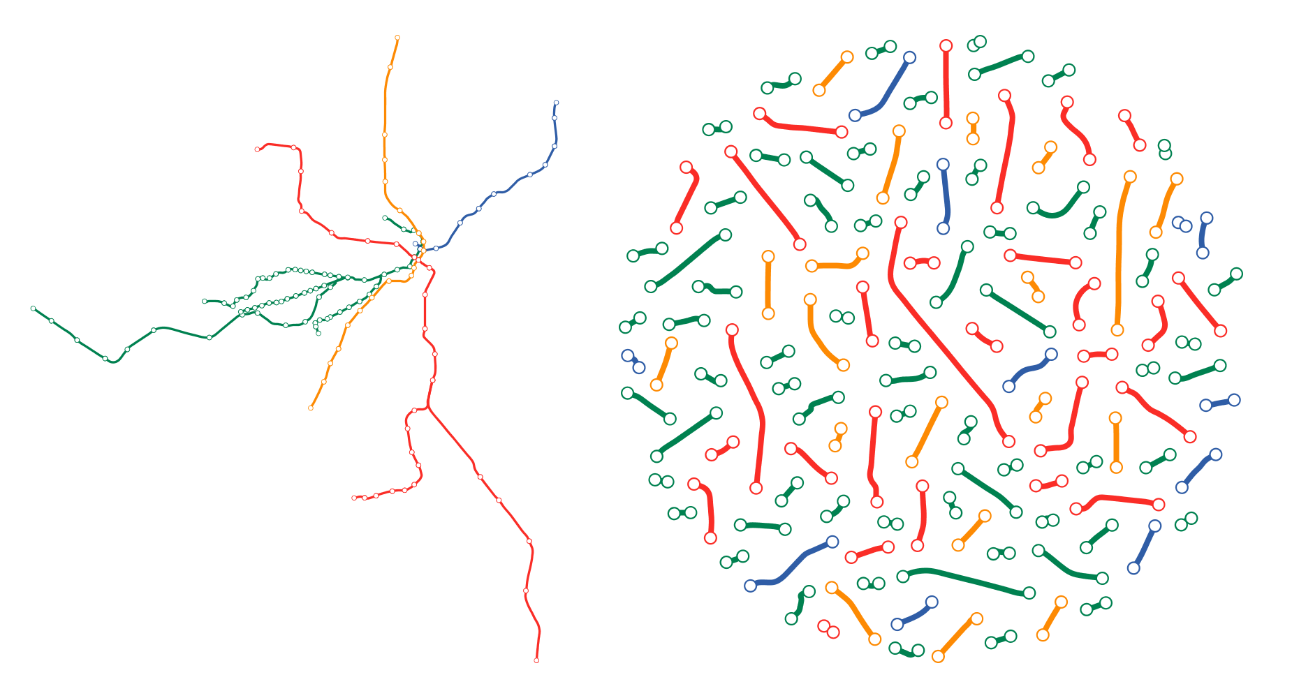
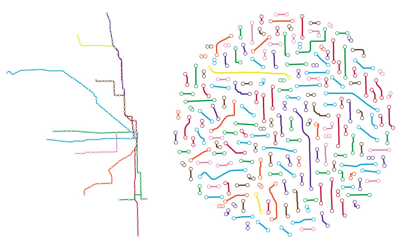
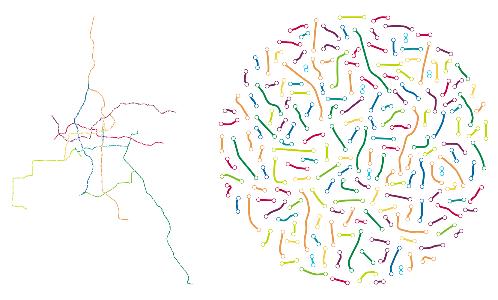
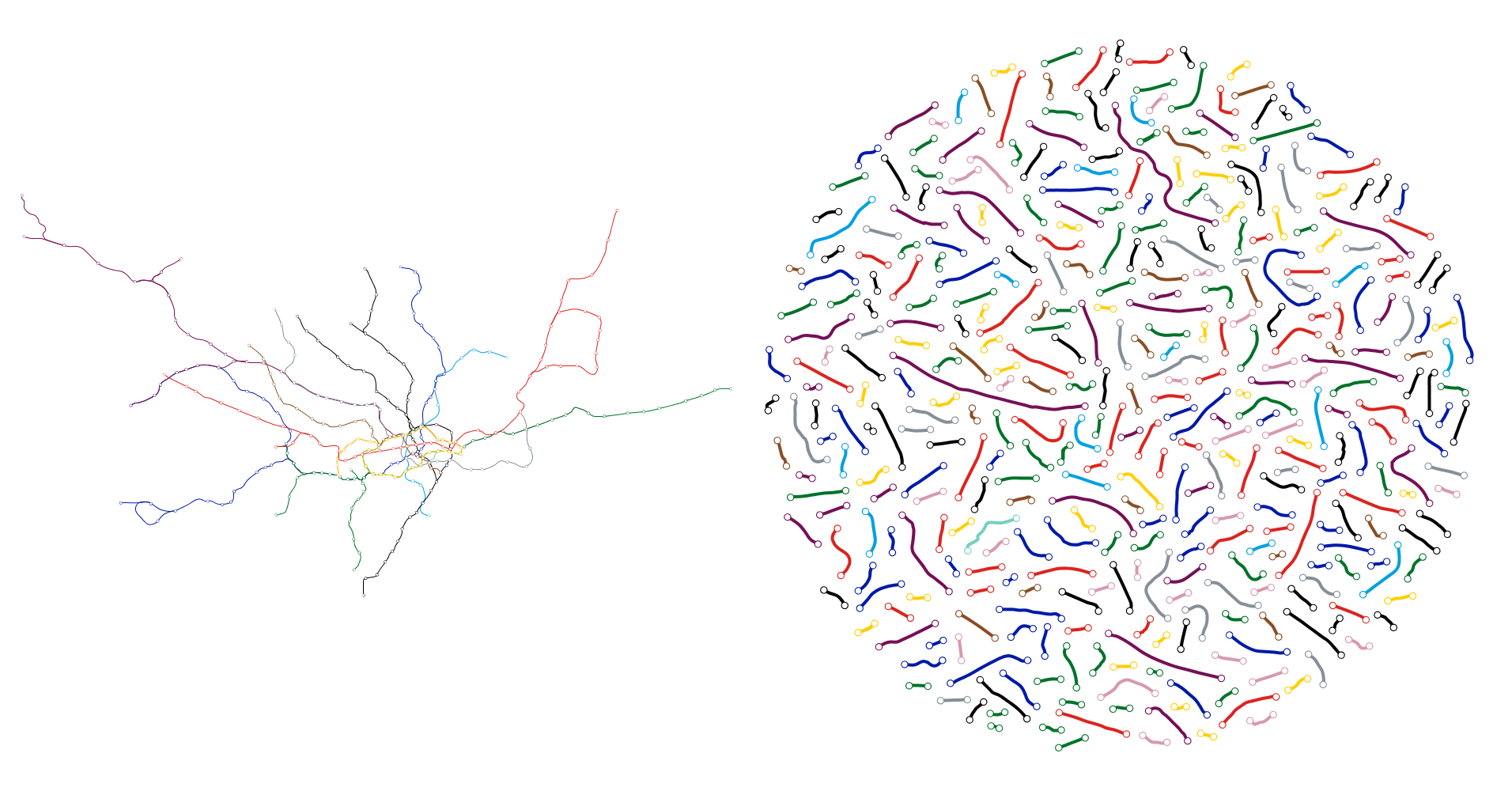
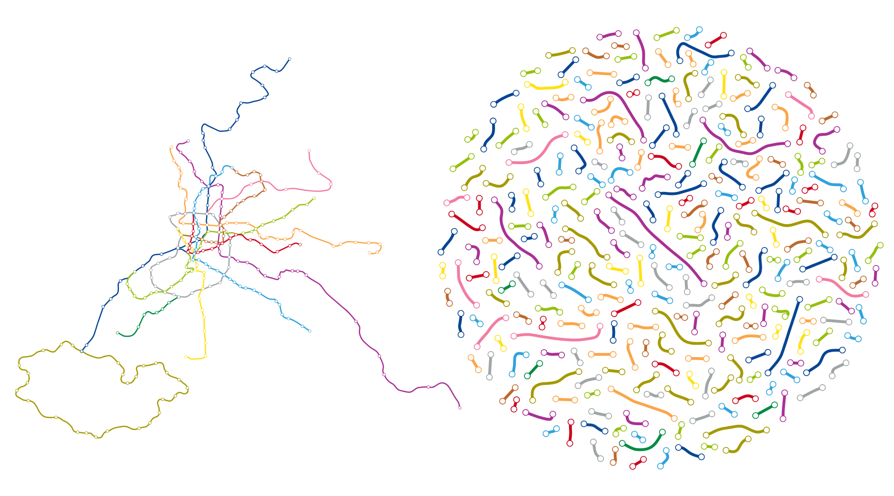
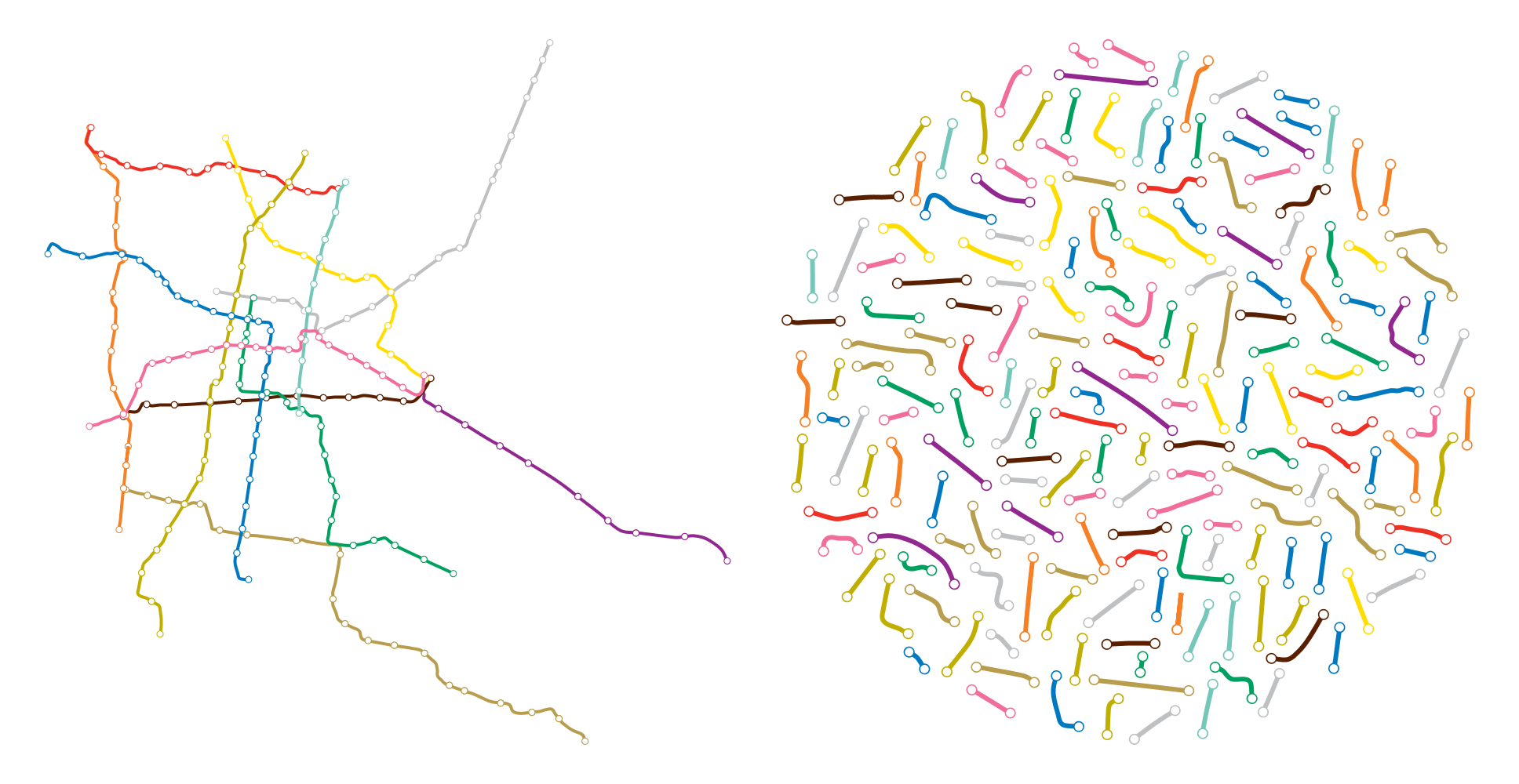
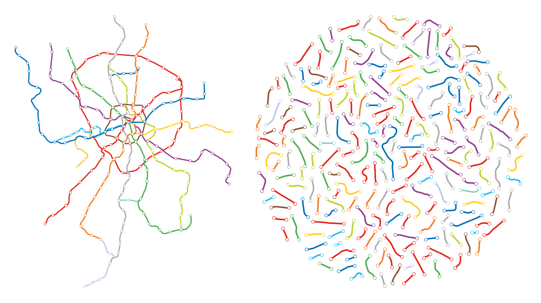
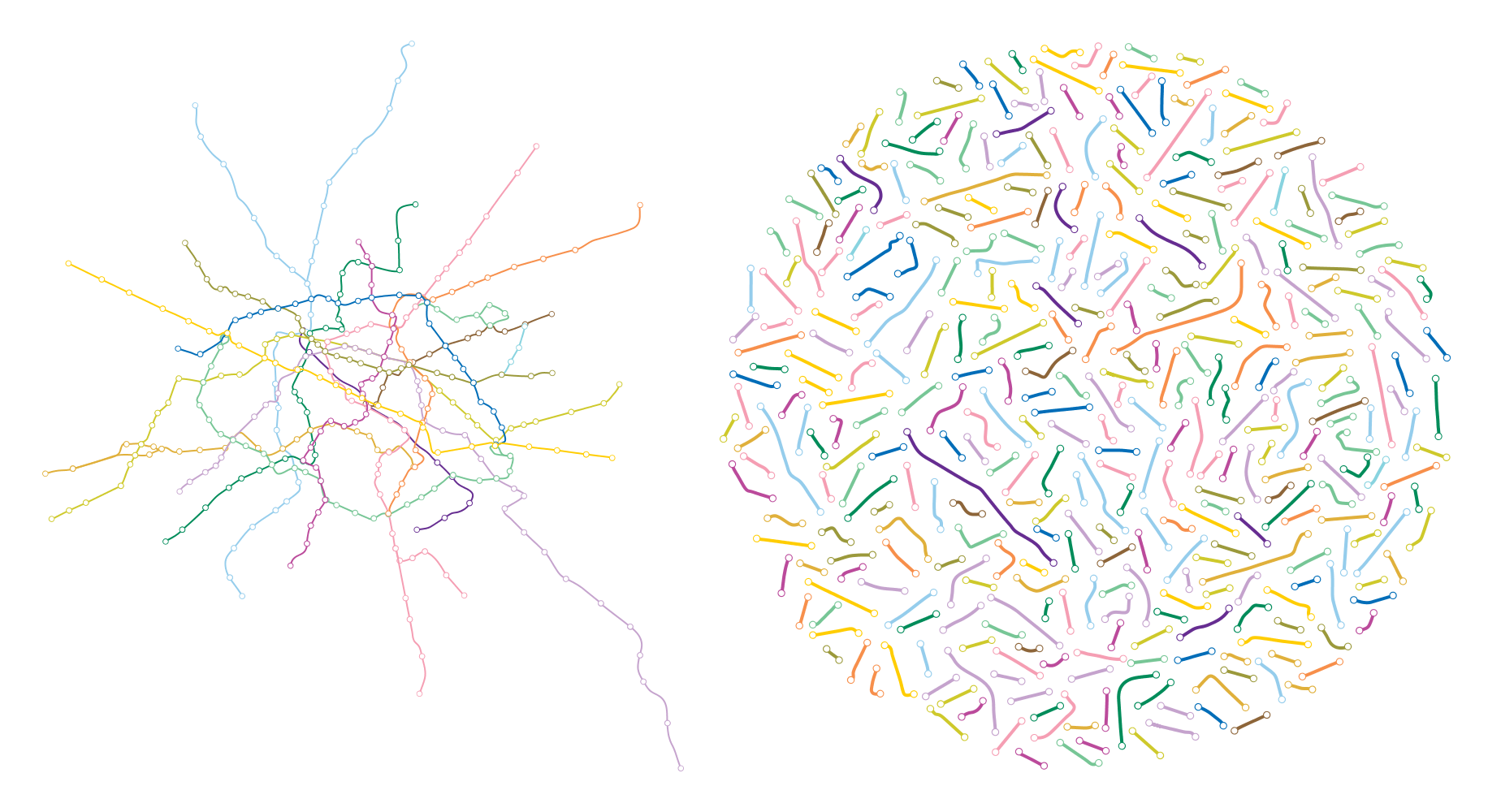
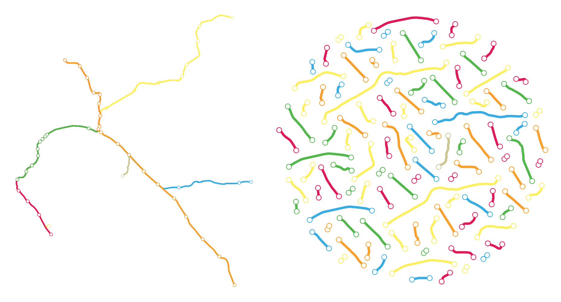
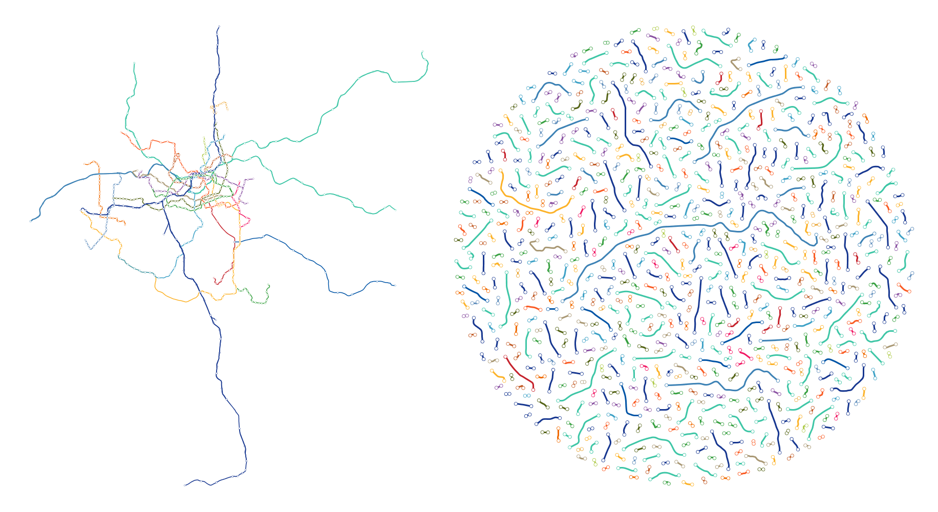
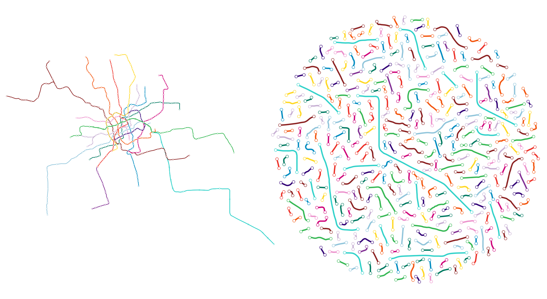
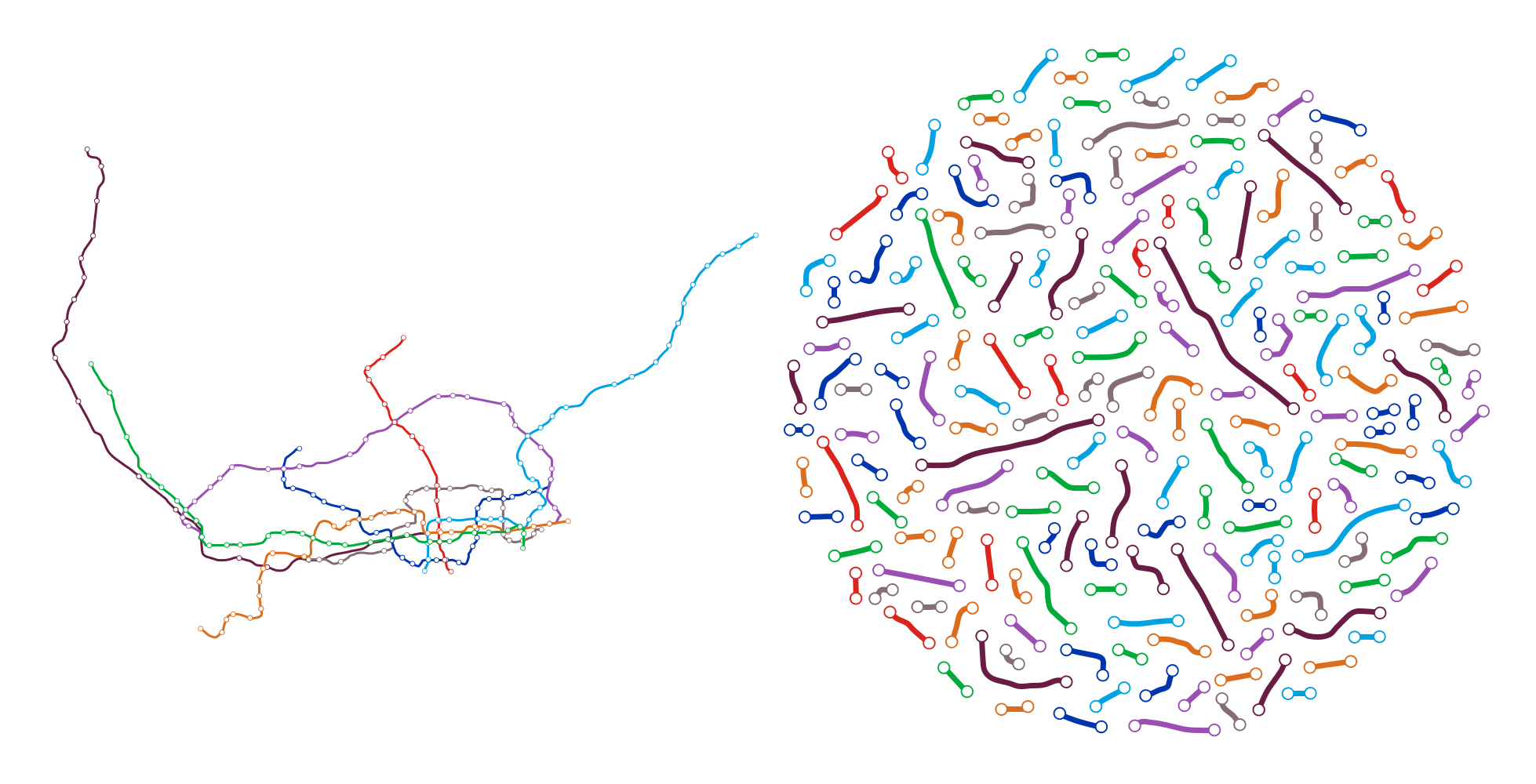
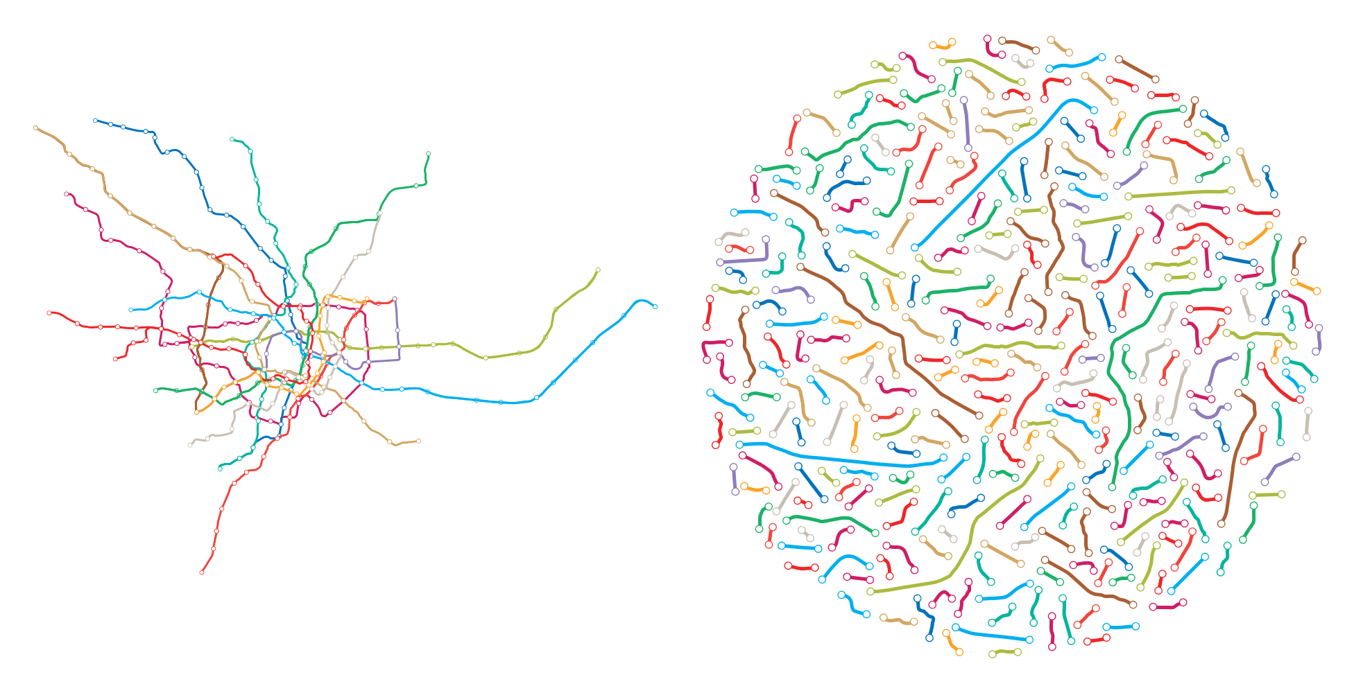
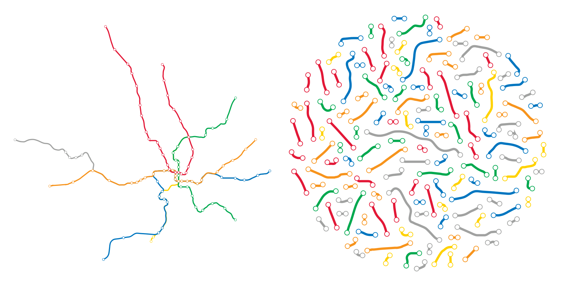
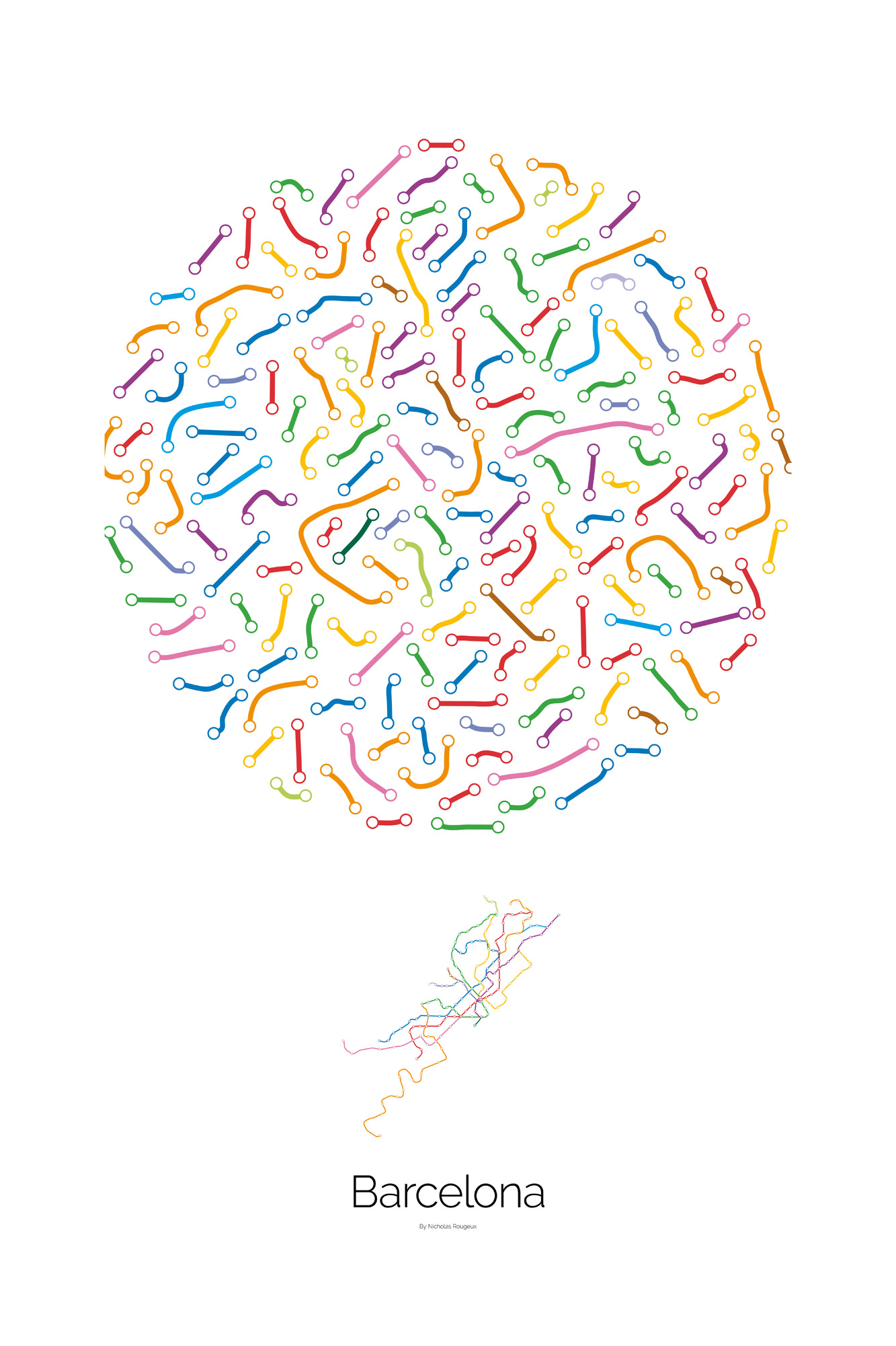
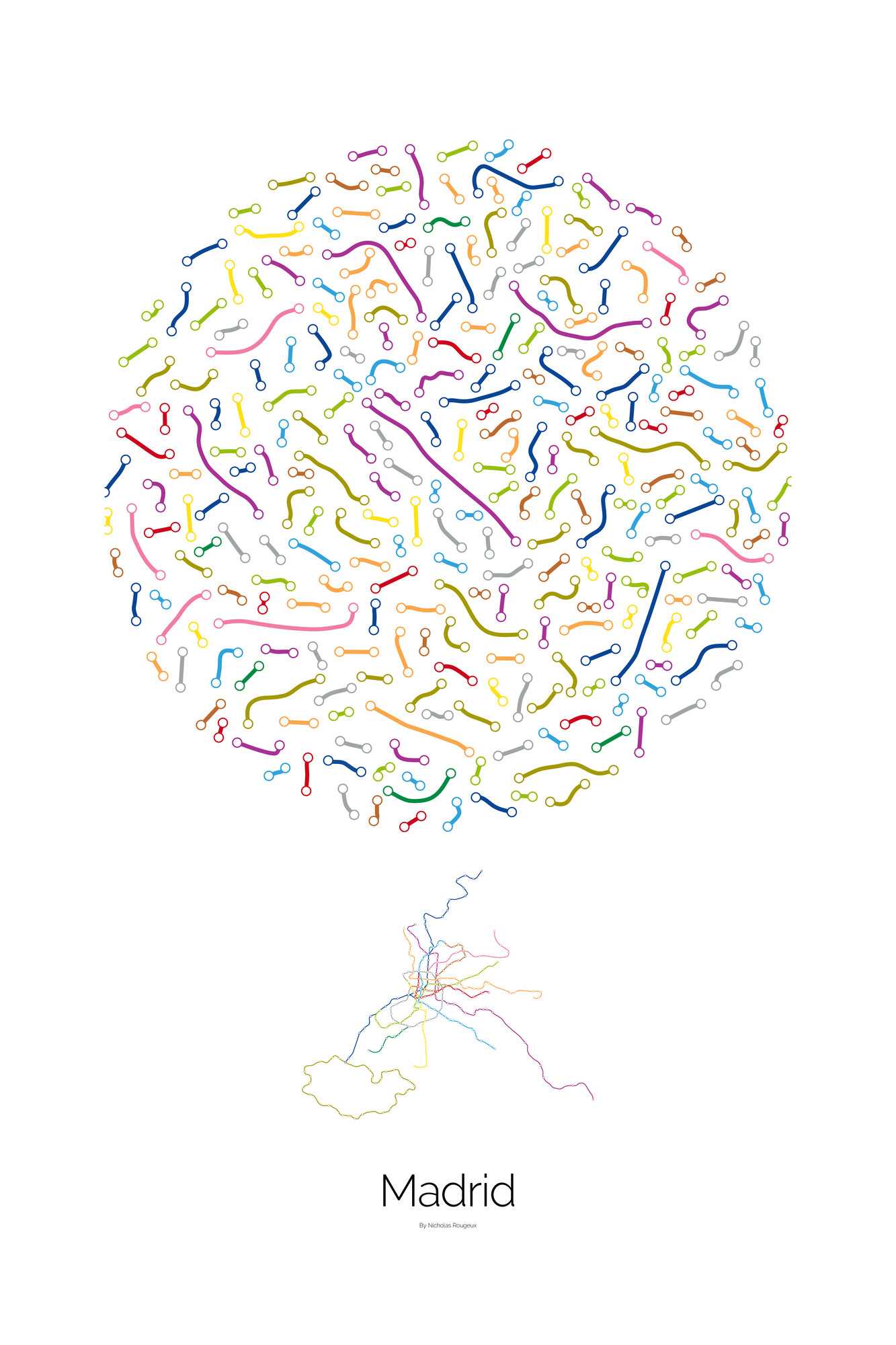
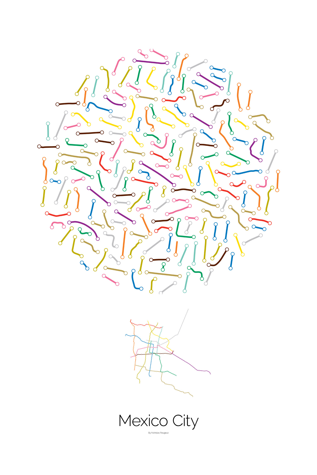
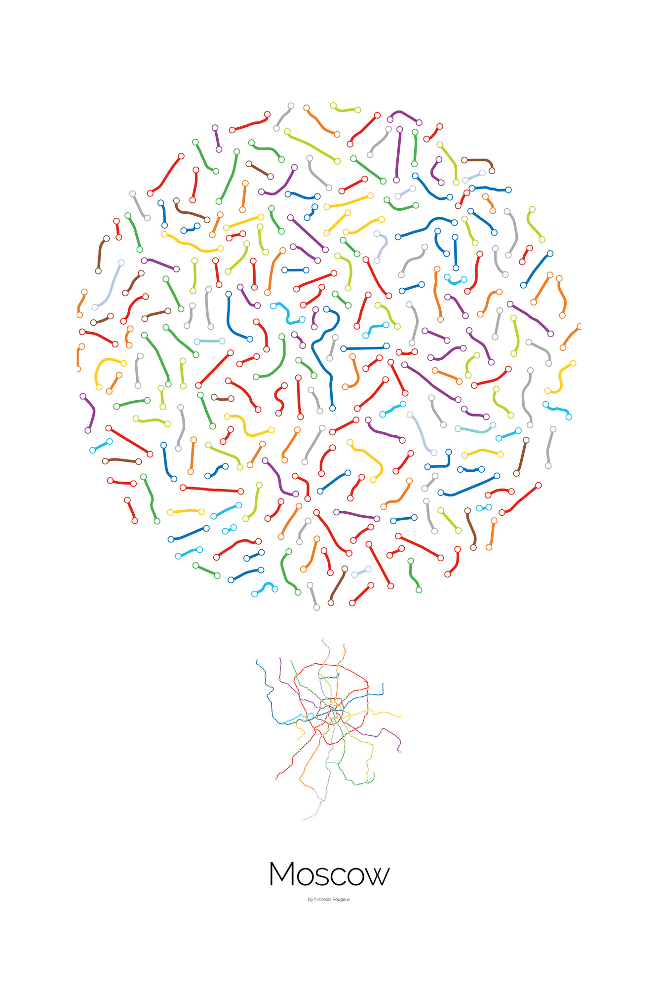
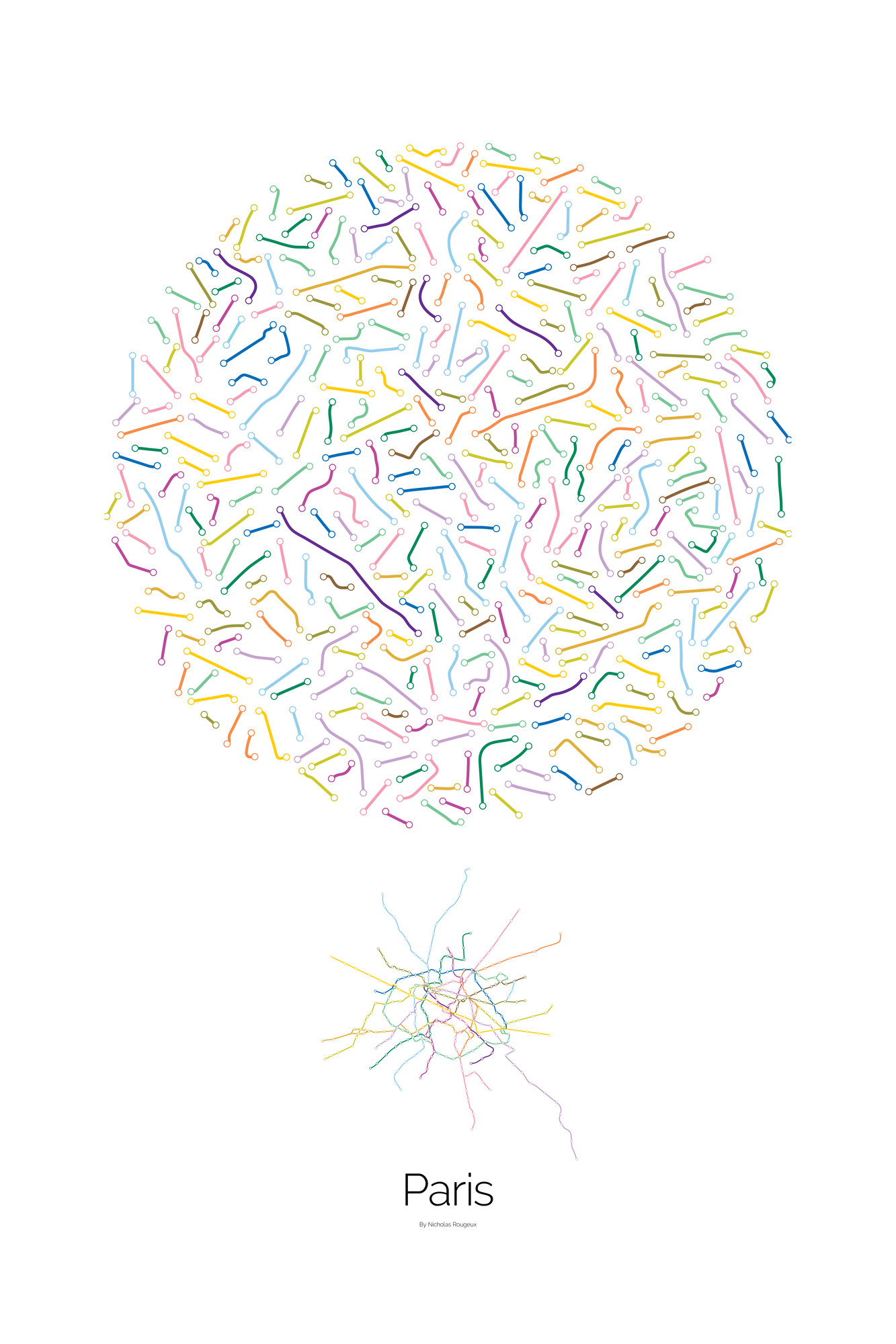
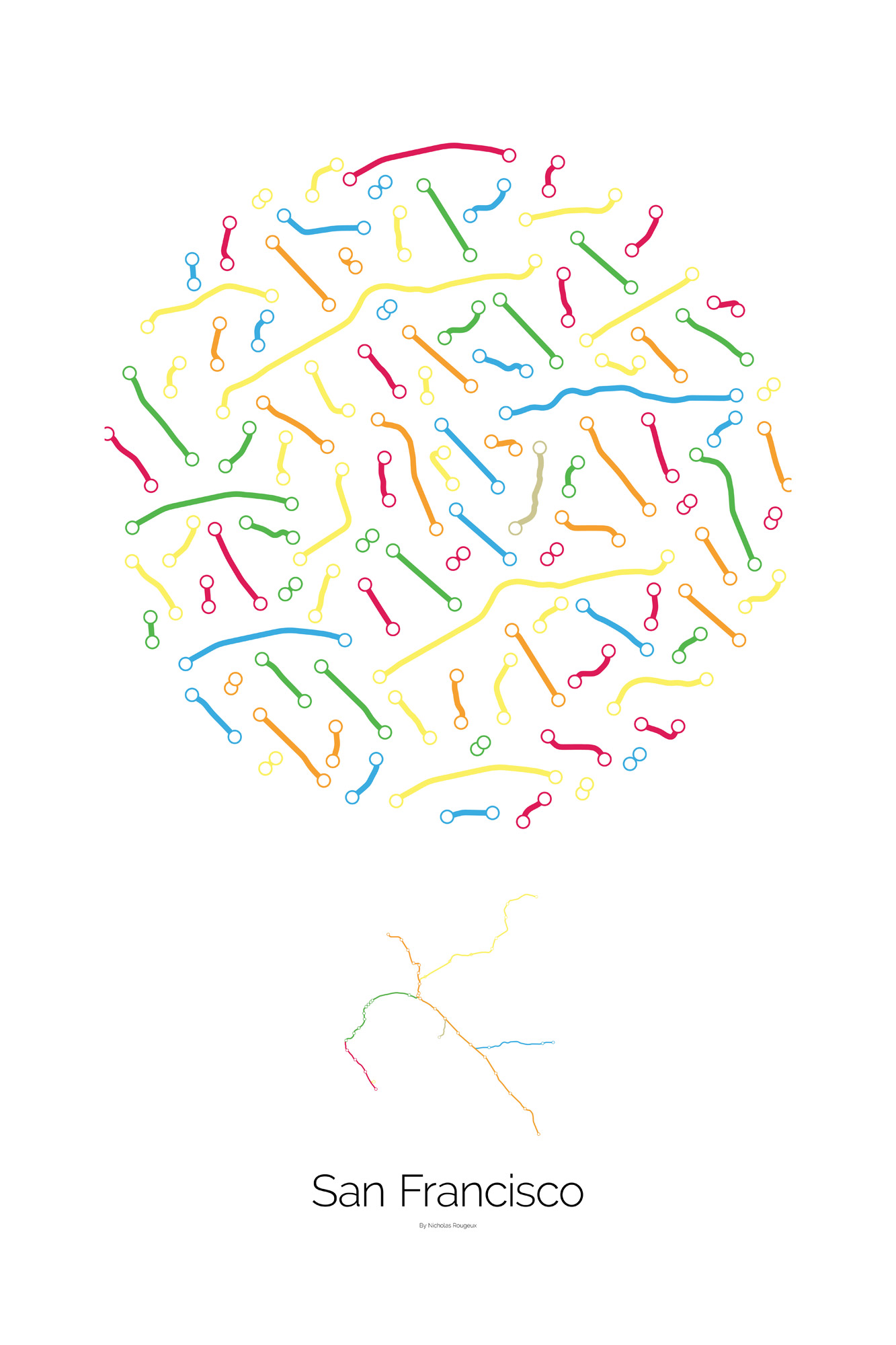
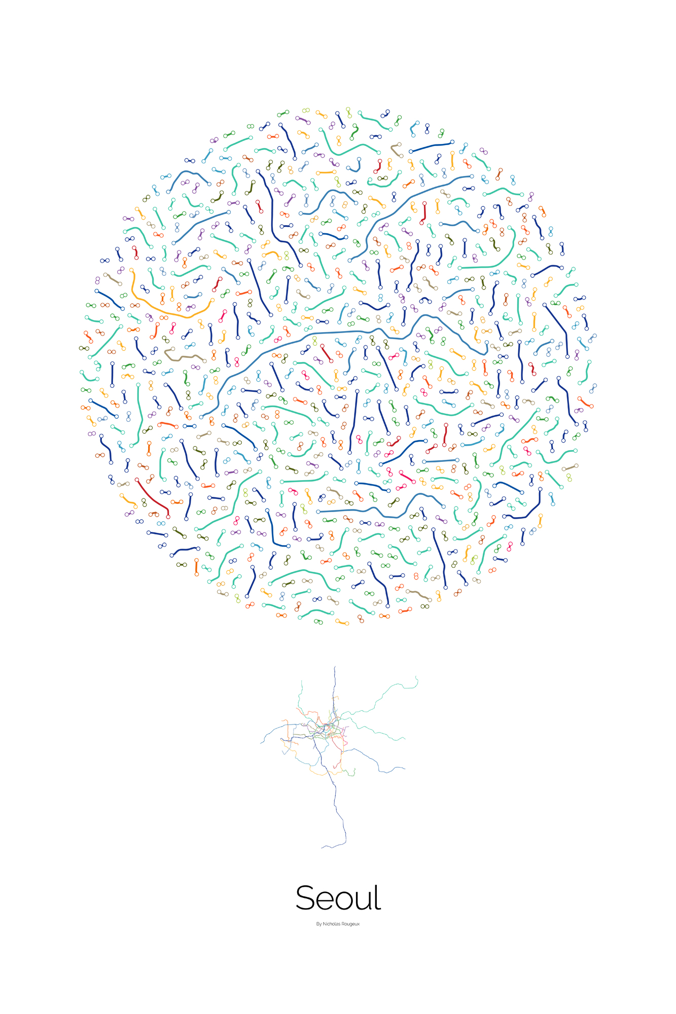
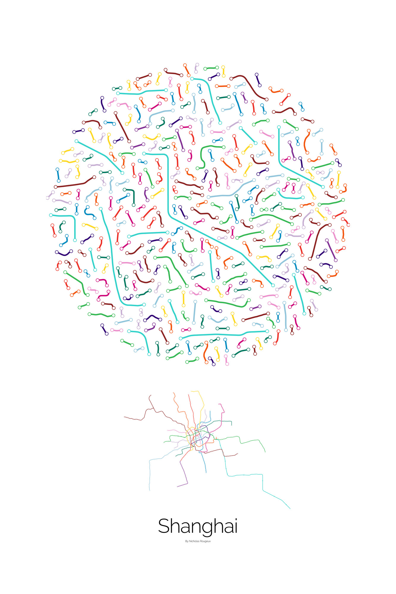
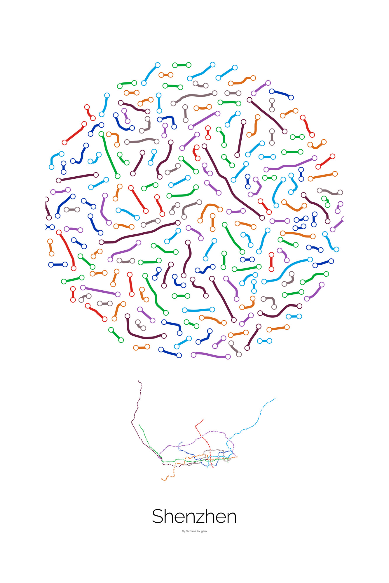
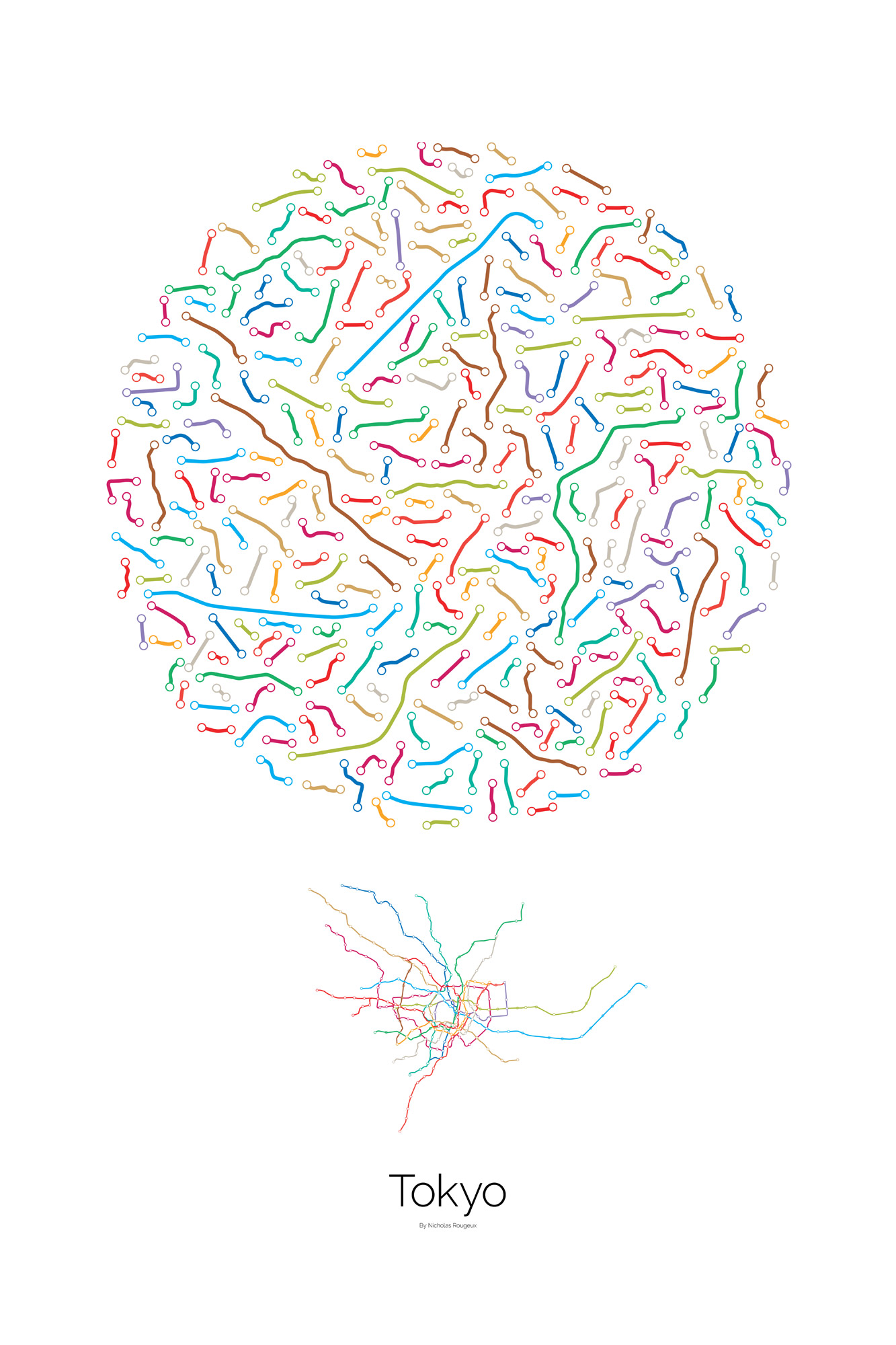
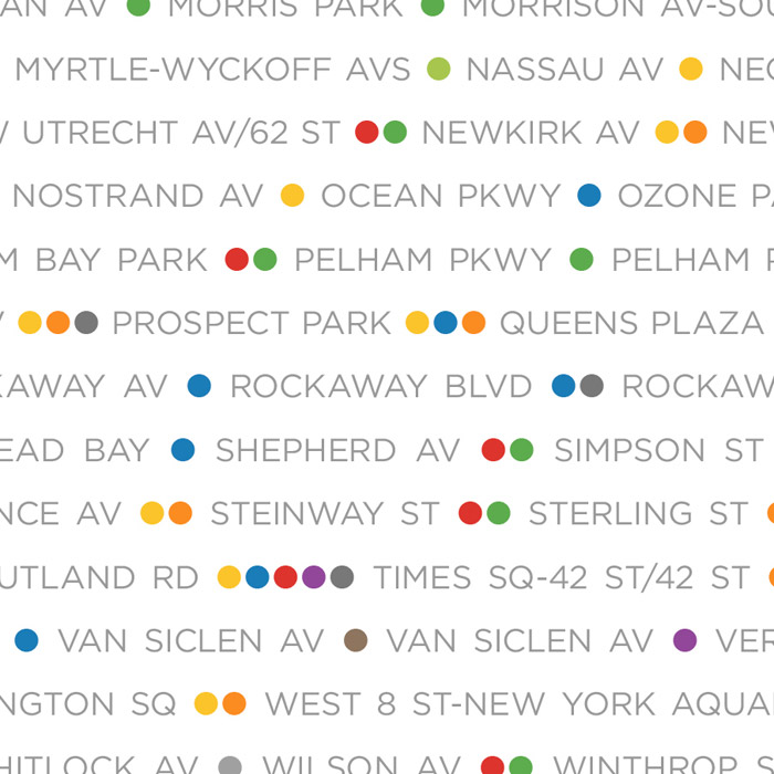
Maps of major subways systems like New York's above were broken down into the segments between each station and rearranged to fill a common simple shape: a circle. Each diagram shows every segment in a subway system while maintaining geographic orientation (no segments were rotated). Some segments serve multiple lines, like in in Chicago where the segment between the Washington/Wells and Quincy stops serves the Purple, Pink, Orange, and Brown lines. In these situations, a segment was included or each using that line's color. Some segments are longer because they represent skipping different schedules serving the same stations.
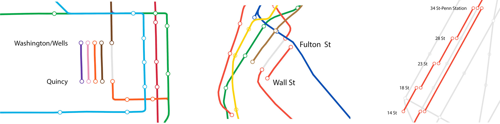
Left: Separate segments created for each line serving the same stretch of track in Chicago between Washington/Wells and Quincy.
Center: Only one segment created between Fulton Street and Wall Street in New York because it's served by the IRT Broadway-Seventh Avenue Line even though the 1, 2, and 3 services use it.
Right: Five different segments created between 34 Street-Penn Station and 14 Street in New York because trains skip the stops between them and stop at each one.
Arranging the segments this way reveals identities for city. Chicago is a grid-based city from north to south and east to west so its diagram has mostly horizontal and vertical segments while London's segments appear more curved because the city's layout is less rigid. New York City's layout has grid-based areas but they're on an angle from true north, so most of the lines are diagonal.
Jump to animations / Jump to posters / See how they were made »
Barcelona
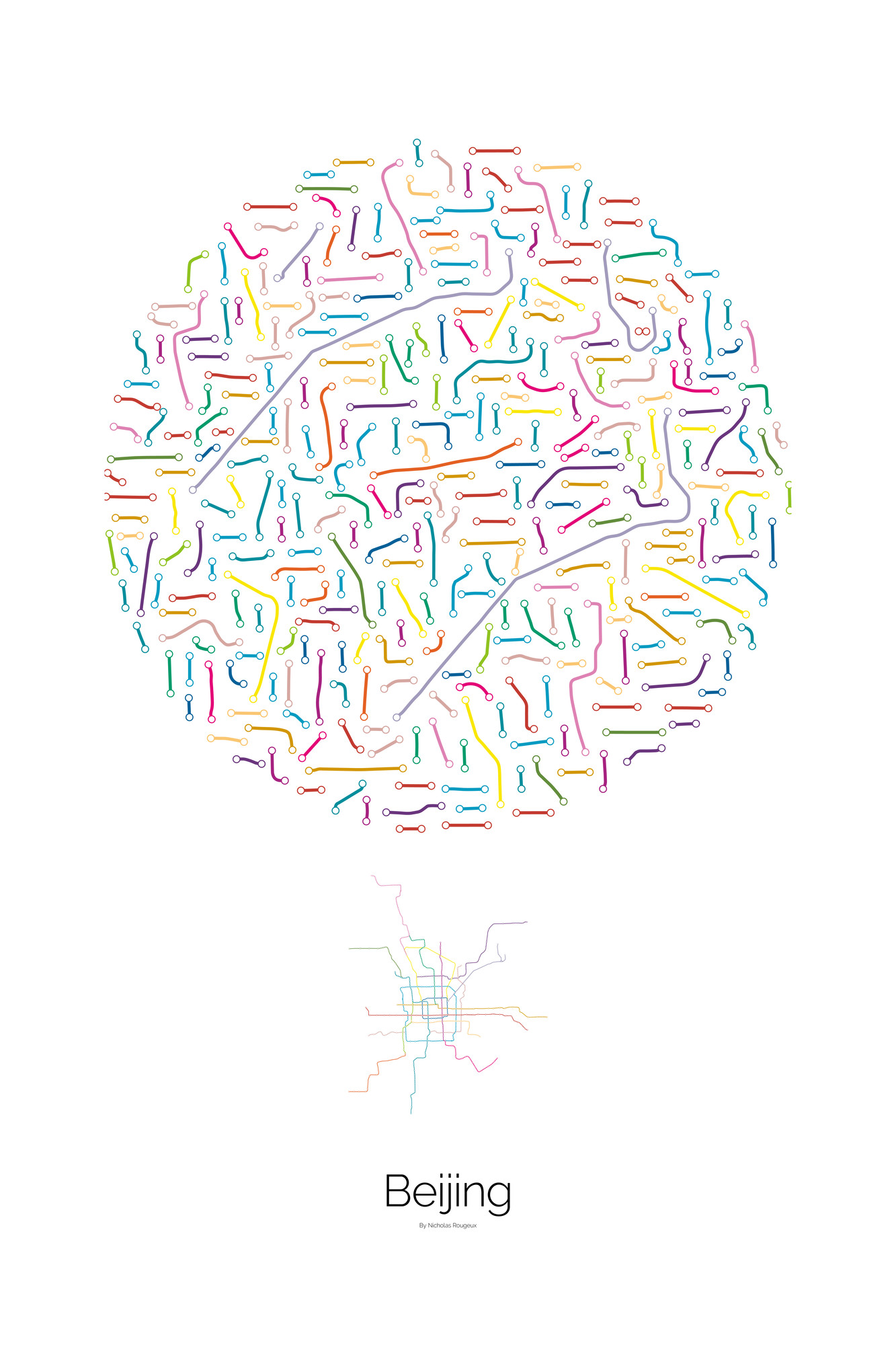
Beijing
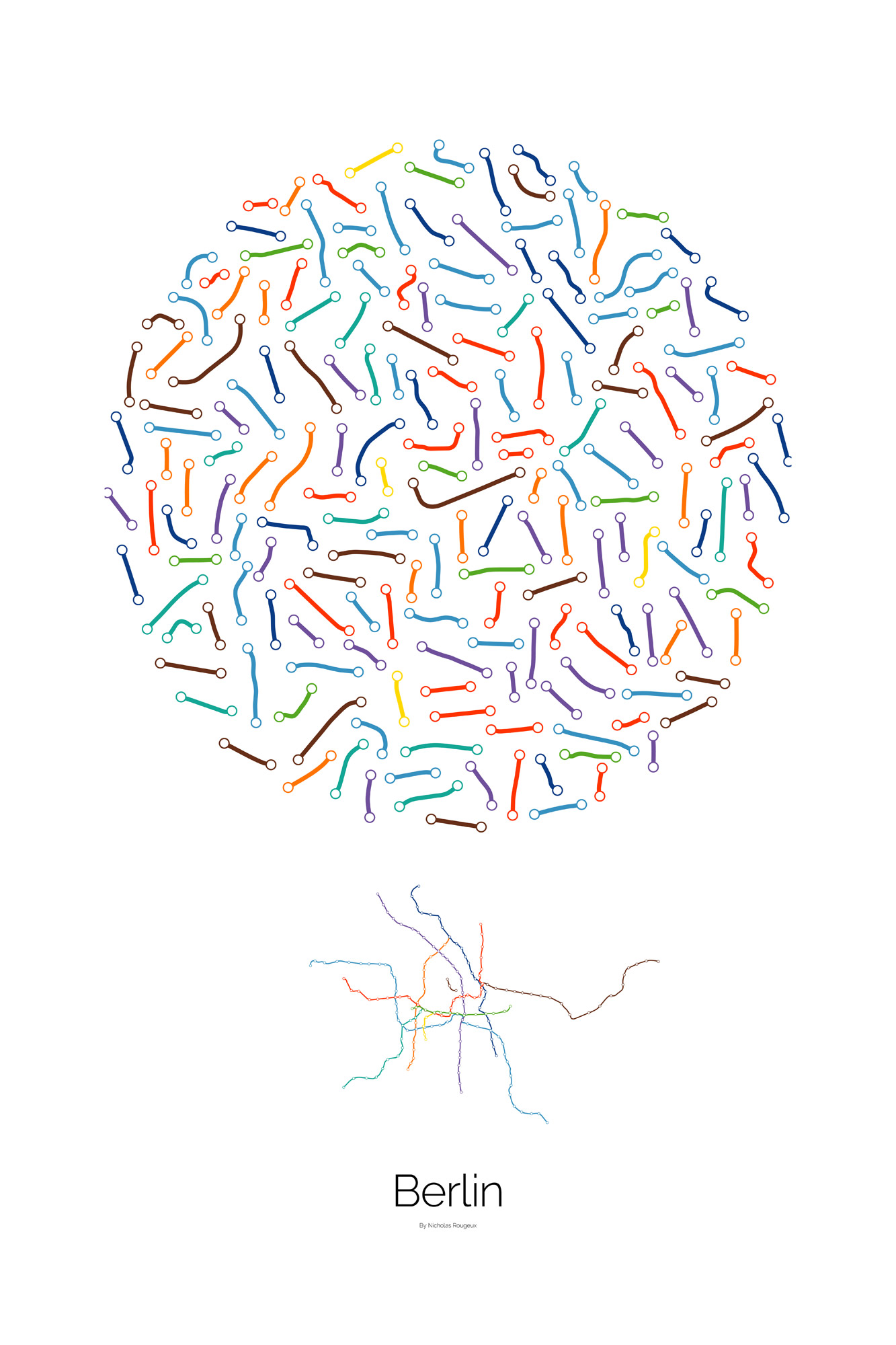
Berlin
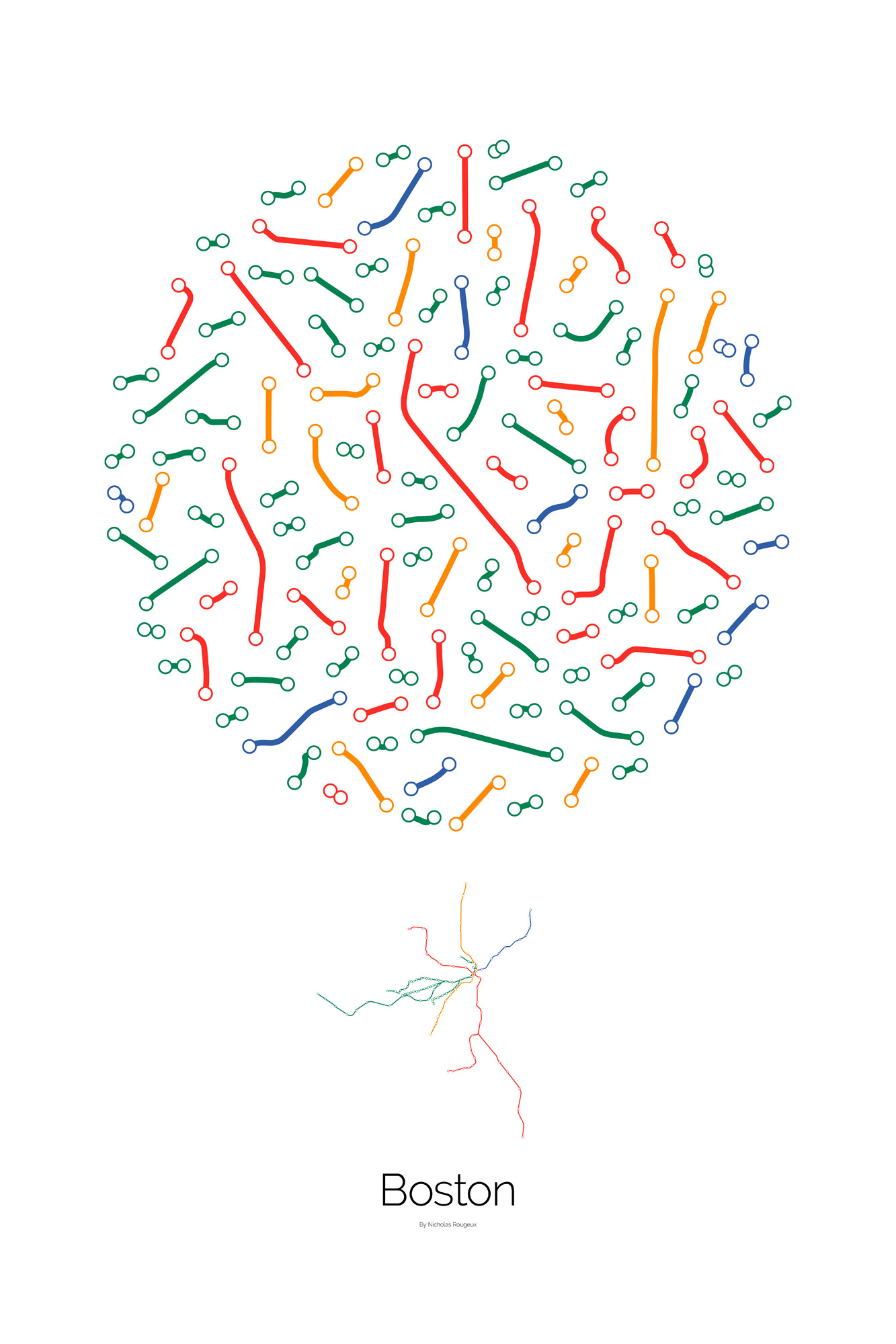
Boston
Chicago
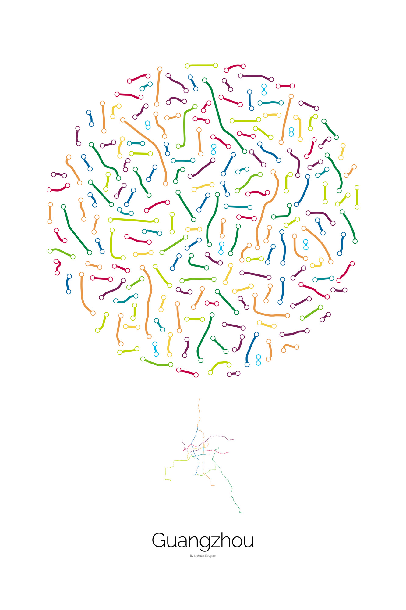
Guangzhou
London
Madrid
Mexico City
Moscow
New York City
Paris
San Francisco
Seoul
Shanghai
Shenzhen
Tokyo
Washington, D.C.
Posters
Starting at $27.80 for 24×36″. More sizes available on ordering page.


Press
- Between stations: exploring the art of subway tracks, October 2, 2017, Nothingintherulebook
Published September 24, 2017

